Version History
Here you can find the changelog of Emlid Flow since it was posted on our website on 2023-03-06.
The latest version is 10.4 and it was updated on soft112.com on 27 April, 2024.
See below the changes in each version:
version 10.4
posted on 2024-04-24
Apr 24, 2024
Version 10.4
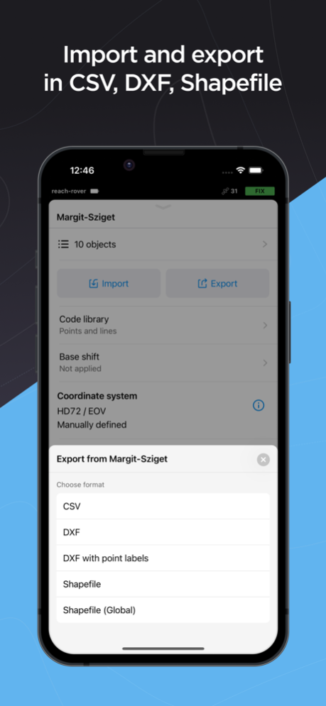
• Emlid Flow now supports import and export of projects in KML format.
• We are pleased to present Czech language support!
• Information about collected points is extended to include GDOP, NTRIP mountpoint info, and the number of satellites for each constellation.
• The Traverse tool now allows you to enter azimuth in the DMS format.
• Minor fixes and visual improvements.
version 10.3
posted on 2024-04-15
Apr 15, 2024
Version 10.3
• We updated the Collector tool with the ‘Precision limit’ setting! Now you have more control over the quality of the data you collect. This new feature is available in both Free and Survey plans.
• Minor fixes and visual improvements.
version 10.1
posted on 2024-03-21
Mar 21, 2024
Version 10.1
• Added the ability to check for Reach RX firmware updates and a more reliable checking mechanism for other receivers.
• Minor fixes and visual improvements.
version 9.12
posted on 2024-02-14
Feb 14, 2024
Version 9.12
• Minor fixes and visual improvements.
version 9.11.1
posted on 2024-02-06
Feb 6, 2024
Version 9.11.1
• The Line Info screen now provides more information about each segment of a line.
• Minor fixes and visual improvements.
version 9.10
posted on 2024-01-16
Jan 16, 2024
Version 9.10
• It’s possible to save calibrated coordinate systems, and then use them in other projects in the same work site. Name the new system and you’re done!
version 9.9
posted on 2023-12-26
Dec 26, 2023
Version 9.9
• Starting with firmware 31.6 you can use Bluetooth to connect to your Reach. This feature is in the beta stage.
• The Line Info screen now provides more information, including area, perimeter, direction, grade, and more. The information depends on the number of points in the line.
• Minor fixes and visual improvements.
version 9.8
posted on 2023-12-14
Dec 14, 2023
Version 9.8
• Sending corrections to the Reach RX will continue even when the app is background or the screen is locked.
• Minor fixes and visual improvements.
version 9.7
posted on 2023-11-29
Nov 29, 2023
Version 9.7
• The stakeout tool now displays the azimuth value. The azimuth value is a measure of the direction from a rover to a target in point stakeout, and to an intersection point in ‘To line’ mode.
• Now your preferred stakeout mode is automatically remembered, providing a smoother experience.
• Minor fixes and visual improvements.
version 9.6
posted on 2023-11-15
Nov 15, 2023
Version 9.6
• With this update, projects with a projection will use grid distances in the calculations. Projects in the Global coordinate system will use ground distances.
• We updated the formatting of distances in the Stakeout tool and line info screen. The new format provides centimeter-level accuracy even for long distances.
• Minor fixes and visual improvements.
version 9.5
posted on 2023-11-02
Nov 2, 2023
Version 9.5
• Added new coordinate systems for Ireland, Germany, and Hong Kong.
• Updated the geoid used for ‘DVR90 height’ to a newer version.
• Survey plan subscribers can now export CSV files with a custom format. The file configuration is taken from Emlid Flow 360.
• Minor fixes and visual improvements.
version 9.4
posted on 2023-10-19
Oct 19, 2023
Version 9.4
• You can now get instant logging feedback right from the status bar and more detailed information from the status overview. In addition, the process of starting and stopping logging is more accessible through the integration of native logging controls.
• Minor fixes and visual improvements.
version 9.3
posted on 2023-10-05
Oct 5, 2023
Version 9.3
• Minor fixes and visual improvements.
version 9.2.1
posted on 2023-10-02
Oct 2, 2023
Version 9.2.1
• We updated the Profile section of the app. You can now find the link for documentation for every Emlid receiver and software product. The offline PDF docs are also available for download at the bottom of the documentation page.
• Minor fixes and visual improvements.
version 9.2
posted on 2023-09-21
Sep 21, 2023
Version 9.2
• We updated the Profile section of the app. You can now find the link for documentation for every Emlid receiver and software product. The offline PDF docs are also available for download at the bottom of the documentation page.
• Minor fixes and visual improvements.
version 9.1.2
posted on 2023-09-15
Sep 15, 2023
Version 9.1.2
• We are introducing a new Stakeout mode! Now the map automatically rotates so you can quickly find your position relative to a point or line. The old Stakeout mode is available by clicking the Follow button on the map.
• Added more options to manage lines: change code, add or remove points, reorder points within a line. Also, you can delete lines while keeping the points.
• The Collector tool now allows to select on which side of the line you want to collect a new point.
• Added a bunch of `WGS84`-based projections for India.
• Added a new vertical datum was introduced for high-precision measurements in Bucharest, Romania—`Bucharest-Ilfov MN75 height`.
• The UTM zones `34N` and `35N` of the `ETRS89` datum are now available for Romania.
• The `Romania MN75 height` was renamed to `MN75 height` and updated and now it uses the latest version of the geoid: `EGG97_QGRJ_2023.tif`.
• Minor fixes and visual improvements.
version 9.1.1
posted on 2023-09-07
Sep 7, 2023
Version 9.1.1
• We are introducing a new Stakeout mode! Now the map automatically rotates so you can quickly find your position relative to a point or line. The old Stakeout mode is available by clicking the Follow button on the map.
• Added more options to manage lines: change code, add or remove points, reorder points within a line. Also, you can delete lines while keeping the points.
• The Collector tool now allows to select on which side of the line you want to collect a new point.
• Added a bunch of `WGS84`-based projections for India.
• Added a new vertical datum was introduced for high-precision measurements in Bucharest, Romania—`Bucharest-Ilfov MN75 height`.
• The UTM zones `34N` and `35N` of the `ETRS89` datum are now available for Romania.
• The `Romania MN75 height` was renamed to `MN75 height` and updated and now it uses the latest version of the geoid: `EGG97_QGRJ_2023.tif`.
• Minor fixes and visual improvements.
version 9
posted on 2023-08-17
Aug 17, 2023
Version 9
• We are pleased to introduce a major update of the Survey plan—Localization. With this new feature you can calibrate your work site to fit existing control points for better precision.
• Minor fixes and visual improvements.
version 8.11
posted on 2023-08-03
Aug 3, 2023
Version 8.11
• Minor fixes and visual improvements.
version 8.10.1
posted on 2023-07-24
Jul 24, 2023
Version 8.10.1
• Survey plan users can now create new lines from existing points. To create new geometries, go to the list of Objects, tap the ‘plus’ icon at the top, and then select points on the map or from the list.
• We added new ‘ETRS89’ to ‘MGI’ transformation that uses the updated 2021 version of the ‘AT_GIS_GRID’ grid. ‘ILUM2 height’ for Israel was also added.
• Unlocked the ability for Survey plan users to edit WMS layers in the Collector and Stakeout modes.
• You can now rotate the project map for better orientation in the field.
• Minor fixes and visual improvements.
version 8.9.2
posted on 2023-06-21
Jun 21, 2023
Version 8.9.2
• You can now search the lists of projects and NTRIP profiles.
• Minor fixes and visual improvements.
version 8.9.1
posted on 2023-06-11
Jun 11, 2023
Version 8.9.1
• You can now search your projects list.
• Minor fixes and visual improvements.
version 8.9
posted on 2023-06-07
Jun 7, 2023
Version 8.9
• You can now search your projects list.
• Minor fixes and visual improvements.
version 8.7
posted on 2023-05-15
May 15, 2023
Version 8.7
• You can now import points using CSV (PENZD) format.
• We added new vertical datums for Thailand (Kolak-1915 height) and Italy (Genoa 1942(South Tirol) height). Support for Israeli CRSs (Israeli Grid 05/12, Israeli Grid 05) has also been added.
• Minor fixes and visual improvements.
version 8.6.1
posted on 2023-04-28
Apr 28, 2023
Version 8.6.1
• You can now select and view point and line information directly from the collect and stakeout modes.
• Minor fixes and visual improvements.
version 8.6
posted on 2023-04-26
Apr 26, 2023
Version 8.6
• You can now select and view point and line information directly from the collect and stakeout modes.
• Minor fixes and visual improvements.
version 8.5
posted on 2023-04-04
Apr 4, 2023
Version 8.5
• Meet the updated object list in the project view! Check out the improved search logic and redesigned display of lines' contents. Note that this update also fixes the ordering of objects when exporting or importing data.
• Minor fixes and visual improvements.
version 8.4
posted on 2023-03-16
Mar 16, 2023
Version 8.4
• Exported DXF files now have a new layer with survey codes.
• Minor fixes and visual improvements.
version 8.2
posted on 2023-02-16
Feb 16, 2023
Version 8.2
- Field names of exported shapefiles were changed slightly to achieve better compatibility with third-party software.
- Minor fixes and visual improvements.